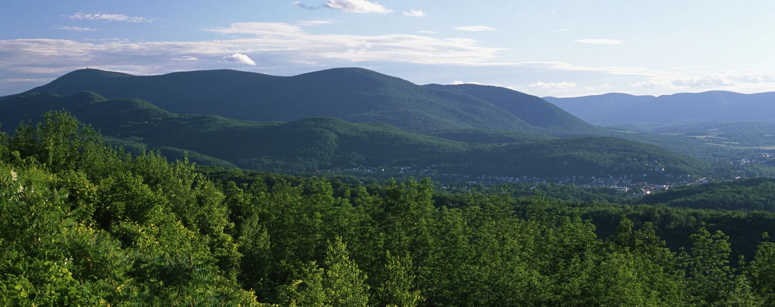
Hiking in the Berkshires
It’s no secret that the Berkshires is home to some incredible hikes; in fact, hiking through the mountains is one of the biggest draws to the region all year long! But with so many trails and options, how is one supposed to choose which ones to tackle?
Well, we’ve done the work for you and compiled a list of some of our favorite trails in the region, starting from the most easy and going up to the most challenging. Better yet, some of them are right down the road from where you’ll be staying in downtown Lenox, making them perfect options for getting your day off to an active start! The lowland hikes typically feature beautiful, lush forests and majestic waterfalls, whereas the higher elevation treks provide spectacular views of the rolling hills below. Whatever your preferences or fitness level may be, there’s an abundance of exceptional hikes to choose from when visiting us here in the Berkshires!

Bash Bish Falls Trail (Mt Washington)
Quick Facts: Less than 1 mile, In and Out Trail, Easy
The Bash Bish Falls Trail is an easy, but rewarding hike that brings you to Bash Bish Falls, the highest single-drop waterfall in Massachusetts at almost 60ft! The trail officially begins right across the border in New York, but you can also access it off of Bash Bish Falls Road just before leaving Massachusetts. The waterfalls are typically at their strongest in the spring and early summer months, but if there has been a lot rain recently, we highly recommend visiting in the middle or end of October to watch the falls while surrounded by the vibrant peak autumn colors.

Sunset Rock Loop (North Adams)
Quick Facts: 1.5 miles, Loop Trail, Easy
The Hoosac Range in North Adams is a hiker’s paradise, with miles of mountainous trails and sweeping views and vistas that are sure to please. And while you can certainly spend a whole day exploring the area, we would highly recommend visiting Sunset Rock (via the Sunset Rock Loop trail) at some point during your visit. The loop itself is under 2 miles round trip and relatively easy compared to some of the nearby trails. On a nice summer evening, there’s nothing more magical than watching the sun set in the west from Sunset Rock while munching on the abundant wild blueberries you’ll find there. But don’t take our word for it, go and experience it for yourself!
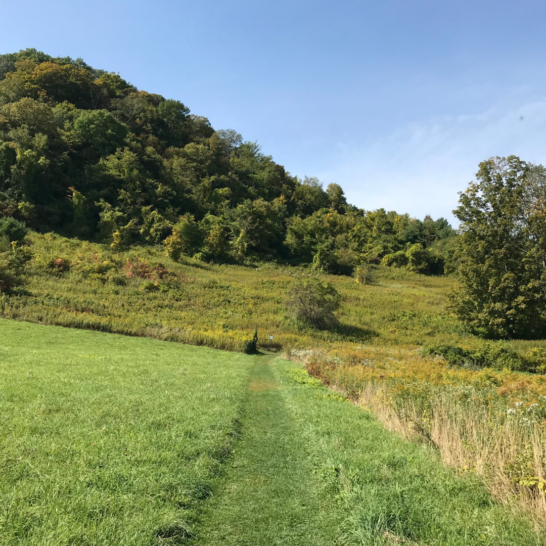
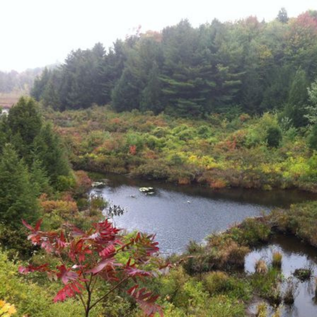
Cobble Hill Loop (Lee)
Quick Facts: 2 miles, Loop Trail, Easy/Moderate
For a mellow afternoon hike close to your home in Lenox, head right down the road to Tyringham Cobble and walk the Cobble Hill Loop. This two mile loop will take you up and around Cobble Hill through lush meadows of grasses and wildflowers. It’s not terribly challenging, although it does ultimately ascend a little bit to the top of the hill, but the views at the top are more than worth it. Tyringham Cobble is the perfect place to enjoy a beautiful summer afternoon in the Berkshires without breaking too much of a sweat; and better yet bring a picnic to really unwind and immerse yourself in the nature around you!

Stevens Glen (Lenox and West Stockbridge)
Quick Facts: 1 mile, Loop Trail, Moderate
Stevens Glen is a fairly popular loop trail located just down the road from Lenox, making it a perfect morning hike to start your day when staying with us! The loop itself is relatively short at just over a mile, but due to the descent and subsequent ascent, it is ranked as moderate difficulty. The forest itself is quiet, lush, and quite beautiful, and depending on the time of year and the weather, you may even find a small waterfall along the trail. Be sure to trek up to the overlook for some beautiful views of the region, including the Stockbridge Bowl just to the east!

March Cataract Trail (Adams)
Quick Facts: 2 miles, In and Out Trail, Moderate
The mountain summit isn’t the only site you should see in the Mt Greylock Reservation! Nestled in the forest, to the west of the mountain itself, you’ll find the March Cataract Trail, leading to the beautiful cascading March Cataract waterfalls. After Bash Bish, these waterfalls are among the most popular in the state, and definitely worth visiting. For the best waterfall experience, plan your visit just after some decent rains, this way the main waterfall will be in full effect, and you’ll be surrounded by several smaller waterfalls throughout the entire hike! The two mile in and out trail is relatively easy to manage, but just be careful as it can get quite slippery when it rains.
The Cascades Trail (North Adams and Williamstown)
Quick Facts: 1 mile, In and Out Trail, Moderate
On the road from North Adams towards Williamstown, you’ll pass by the Cascades Trail, a short and relatively easy hike that will take you into a beautiful gorge with its own waterfall. The trail and falls are not as well traveled as some of the other waterfall trails in the region, so don’t be surprised if you happen to have this route all to yourself during your visit! The trail is very straightforward and moderately difficult, but be warned; after heavy rains the trail does become incredibly slippery and borderline dangerous as it’s nestled along a mountainside, so please proceed with caution.
Burbank Trail (Lenox)
Quick Facts: 3.5 miles, Loop Trail, Moderate
Beginning in the same location as the Charcoal Trail to Olivia’s Overlook, the Burbank Trail provides an equally enjoyable hike, albeit a bit easier. While this loop is longer, it features many flat sections, breaking up the ascents and descents into much more manageable chunks. The trail runs along the Yokun Ridge, and while it is mostly forested, you’ll have a couple of great viewpoints right in the middle and a stop at Monks Pond towards the end. Be on the lookout for fresh wild raspberries in the summer months that are known to pop up on and around the trail!

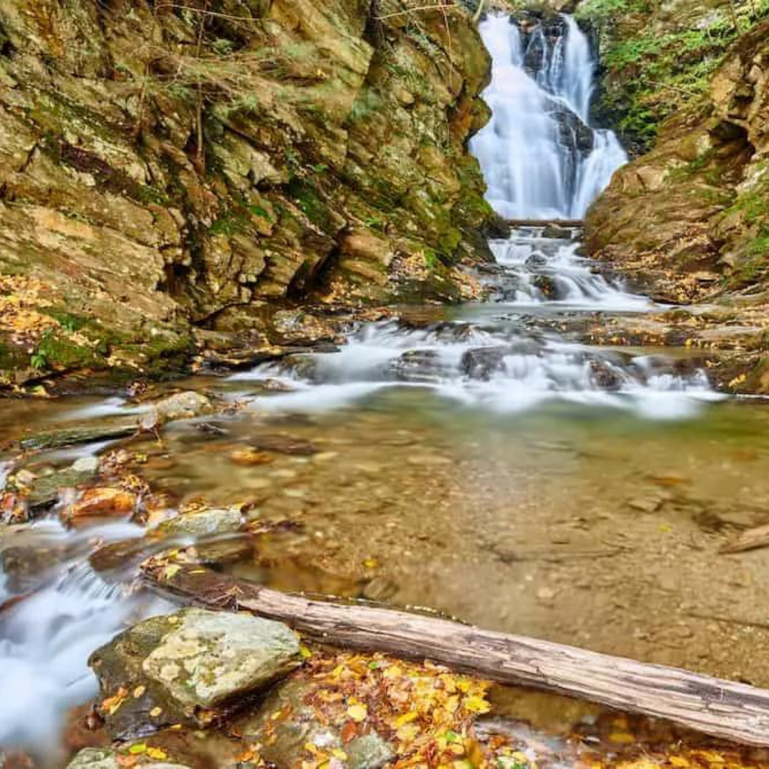
Tannery Falls Trail (North Adams and Williamstown)
Quick Facts: Less than 1 mile, Loop Trail, Moderate
The Tannery Falls Trail is a short, but challenging trail that, as the name suggests, takes you past some beautiful waterfalls, making it more than worth the effort! The trail starts by descending down the stairs into the woods shortly after beginning, and soon enough you will reach the first of the waterfalls. When you’re ready, continue onwards with the descent and you’ll pass more beautiful cascades until you reach the bottom, and at this point you need to make your way back up! Don’t worry though, the ascent runs along the falls so it’s still quite enjoyable! The trail ends on Tannery Road, just a short ways away from the parking lot and trailhead.
Basin Pond Trail (Lee)
Quick Facts: 2 miles, Point to Point Trail, Moderate
The Basin Pond Trail is something of a hidden gem here in the Lenox/Lee area. The trail itself is not too challenging, but its clever design winds its way up rocky slopes, surrounded by numerous cascading brooks and streams. You’ll also find some beautiful stonework throughout that add to the overall aesthetics of the hike. Because of this design, the Basin Pond Trail is one of the most unique in the region, providing visitors with a fully immersive experience into nature. Be sure to take the detour and head up the short Dam Spur Trail for the best views of Basin Pond!

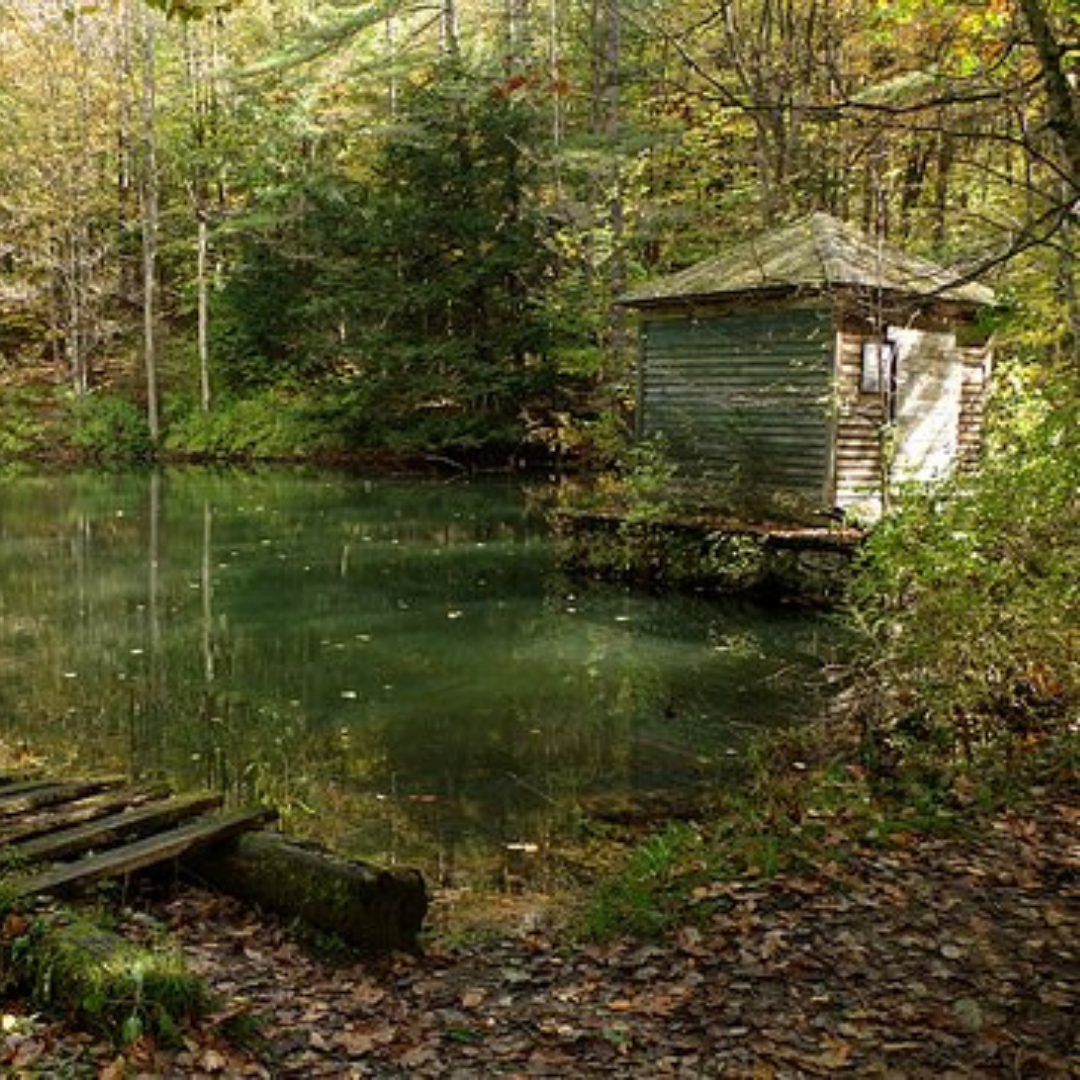
Finerty Trail (Lee)
Quick Facts: 2 miles, In and Out Trail, Moderate
The Finerty Pond Trail is a two mile trek located right near the Basin Pond Trail in Lee. The hike itself is fairly straightforward and not too difficult, but the main draw to the trail is Finerty Pond itself, a beautiful little lake where you’ll feel worlds away in the middle of pristine nature. When you do reach the end, right before coming to the pond, you’ll intersect the Appalachian Trail, but if you’re not up for that adventure feel free to relax at the pond for a bit before making your way back down the way you came. We certainly won’t judge!

The Appalachian Trail (Entire Region)
Quick Facts: 90 miles, Continuous Trail, Moderate/Difficult
For about 90 miles, the famous Appalachian Trail winds its way through the entire Berkshires region. Following the Massachusetts section of the trail, you’ll begin in the south near Mt Everett and ascend to its peak, only to then work your way up and through East Mountain and October Mountain State Forests for some spectacular views of the region. Proceeding further north, you’ll then sharply drop down into North Adams and begin an ascent once again as the Massachusetts trail ends and the Vermont section begins. If you’re up for an adventure, the trail winds through many small, cozy towns and provides one of the best ways to experience all that the Berkshires has to offer. But don’t worry, if you’re not up for the multi-day, 90 mile hike and only want to do a section or two, there are plenty of opportunities to hop on and off the trail throughout its length.

Bellows Pipe Trail (Adams and North Adams)
Quick Facts: 6 miles, In and Out Trail, Moderate/Difficult
The Bellows Pipe Trail is arguably the most popular ascent up Mt Greylock, but be warned as it is quite steep and challenging. The trail begins after the gravel path at the parking lot at the end of Gourd Road; once the path ends, you’ll find yourself ascending quite quickly and steadily from here on out! The trail does intersect many others within the reservation, so be sure to pay attention so as to follow the right path. Once you do make it to the top though, the views from the summit of Mt Greylock will be more than worth the work you put in to get there!

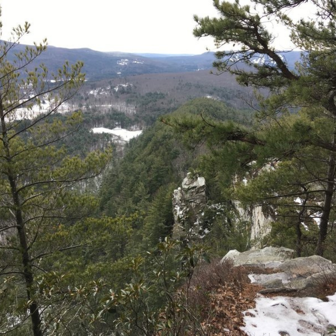
Pine Cobble Trail (Williamstown)
Quick Facts: 2 miles, Point to Point Trail, Difficult
Pine Cobble is one of the most popular hikes in the northern Berkshires, and at two miles each way with a steady ascent of over a thousand feet, it’s best to budget a whole day for this difficult trail (or at least half a day). The trail climbs through some beautiful, dense forests rich in biodiversity, and you’ll encounter a few different spur trails leading to some incredible viewpoints, with the Pine Cobble Summit being the most popular. Once at the end, feel free to continue onwards on the Appalachian Trail, or make your way back down via the equally challenging Class of 98’ Trail. Either way though, prepare for an intense hike that will surely have you breaking a sweat!

Father Loop at Alford Springs (Great Barrington)
Quick Facts: 4 miles, Loop Trail, Difficult
The Father Loop Trail at Alford Springs is not for the faint of heart. This very challenging, four mile long, loop/point to point hike ascends and descends several hills and mountains along the Massachusetts/New York border. And while it is heavily forested, you’ll still encounter several open areas that provide spectacular views of the Berkshires and the mountains of New York State. Plan to budget a full day for the full loop hike, but if you want something a little less demanding in the area, we recommend opting for the neighboring Mother Loop for an easier, shorter, but equally enjoyable trek.

Charcoal Loop Trail (Lenox)
Quick Facts: 2 miles, Loop Trail, Difficult
Olivia’s Overlook is one of the most popular outdoor attractions in the Lenox area, and with it, the Charcoal Loop Trail. The trail itself is just under two miles around, but what it lacks in distance it more than makes up for in difficulty, steadily ascending and descending throughout the entire loop. Once you reach the overlook, you’ll be treated to a stunning view of the Stockbridge Bowl and the rolling hills of the region. For the best experience, make the trip up in the middle of October for an even more breathtaking display, with an endless sea of fall colors stretching as far as the eye can see!

Mohawk Trail Loop (Florida)
Quick Facts: 5 miles, Loop Trail, Difficult
The Mohawk Trail Loop is one of the most highly rated and popular trails in the entire Berkshires region. This five mile loop takes visitors through some spectacular wilderness and old growth forest as it winds its way through the scenic Mohawk Trail State Forest. The majority of the trail is fairly straightforward and not too difficult, but the second half runs along the very steep slopes of Todd Mountain, and most people find this section to be incredibly challenging. Proceed with caution here and take your time on this section in particular. And of course, while you’re here, don’t forget to actually take the detour to the top of Todd Mountain and take in the incredible view from the summit!

Schermerhorn Gorge Trail (Lenox and Lee)
Quick Facts: 2 miles, Loop Trail, Difficult
Nestled in October Mountain State Forest, the Schermerhorn Gorge trail is a short, but challenging loop that provides the best views of the falls in the gorge. In fact, you’ll see the falls right at the beginning of the trail, but we do encourage you to actually tackle the hike and experience the beauty of the forest. The trail ascends steadily up to its end at Felton Lake, where you can either merge onto a new trail, make your way back down the other half of the loop, or just relax at the lake and enjoy the picnic area high up in the mountains.
Squaw Peak Trail (Monument Mountain Reservation)
Quick Facts: Less than 1 mile, Point to Point Trail, Difficult